Marine safety: A guide for hurricane preparedness

By AXA XL Senior Risk Consultant, Marine, Jarek Klimczak
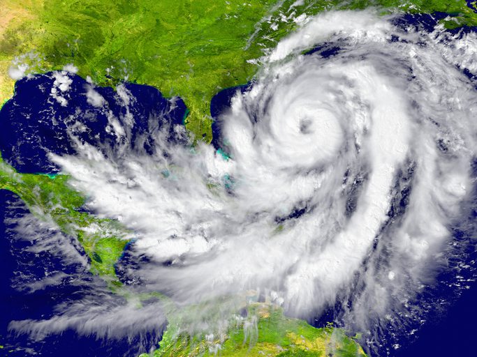
Hurricane Ida hit Port Fourchon hard last year. Located on the southern tip of Louisiana’s Lafourche Parish and on the Gulf of Mexico, Port Fourchon is the state’s southernmost port. Considered the heart of the offshore oil industry, the seaport hosts significant petroleum industry traffic from offshore Gulf oil platforms and drilling rigs as well as the Louisiana Offshore Oil Port pipeline.
With maximum sustained winds of 150 miles per hour, Hurricane Ida was the strongest hurricane to ever hit Port Fourchon. Sixteen years before, Hurricane Katrina came ashore but 60 miles east of Port Fourchon.
As a result of Ida, more than 95% of U.S. Gulf of Mexico oil production was temporarily suspended. The Gulf supplies nearly a fifth of the nation’s oil. Waterways had to be surveyed because debris was scattered everywhere. Local homes were damaged. More than a million people were left without power.
Preparing for 2022’s predictions
Given the importance of our nation’s ports, their vulnerability to hurricanes because of their coastal locations, and 2022 hurricane predictions, preparedness cannot be taken lightly.
According to the National Weather Service, six hurricanes form in the Atlantic Ocean, Caribbean Sea, or Gulf of Mexico during an average hurricane season. Over a typical two-year period, the U.S. coastline is struck by three hurricanes; one is usually classified as major (Category 3 or higher) with winds of 130 mph or greater.
Researchers note that storm seasons may become more severe in the future. Rising sea levels are contributing to more flooding, and the National Oceanic and Atmospheric Administration predicts that severe flooding may worsen.
NOAA’s Climate Prediction Center says to expect between 14-21 named storms, including 6-10 hurricanes and 3-6 major hurricanes packing sustained winds of at least 111 miles per hour. The forecast points out that this year’s forecast of 3-6 major storms represents a wide range and does not include predictions of where any hurricanes might land.
Improvements in computer-based numerical weather prediction models have led to better hurricane forecast accuracy by NOAA. Today’s average 5-day track forecast by the National Weather Service is as good as the 3-day track forecast was 10 years ago.
Hurricane risks
High winds are a familiar risk associated with a hurricane. Wind speeds of 70 to 130 mph are common but can reach up to 150 mph as they did in Hurricane Ida. The force created by such winds is tremendous and when wind speed doubles, the wind pressure quadruples. In practical terms it means that damage rate increases much faster than wind speed.
Other harmful conditions brought on by tropical storms and hurricanes include:
Rainfall – Tropical cyclones often produce widespread, torrential rains in excess of 6 inches, which may result in deadly and destructive floods.Waves – can cause extreme waves. Waves and storm surges are responsible for severe flooding.Flood – is the major threat from tropical cyclone. Flash flooding, defined as a rapid rise in water levels, can occur quickly due to intense rainfall. Longer term flooding on rivers and streams can persist for several days after the storm.Storm surge – is water from the ocean that is pushed toward the shore by the force of the winds swirling around the hurricane. This advancing surge combines with the normal tides and can increase the water level by 30 feet or more. NOAA uses a computer model called SLOSH to predict storm surge heights. The model depends critically on the hurricane’s track, intensity, and size.Storm tide – the water level rise during a storm due to the combination of storm surge and the astronomical tide.Tornadoes – Hurricanes and tropical storms can also produce tornadoes. These tornadoes most often occur in thunderstorms embedded in rain bands well away from the center of the hurricane; however, they can also occur near the eyewall. Usually, tornadoes produced by tropical cyclones are relatively weak and short-lived, but they still pose a significant threat.
Assessing port conditions
The U.S. Coast Guard classifies port conditions during hurricanes at four different levels, with mandated procedures for port operations at each level:
WHISKEY: Gale force winds (39-54 mph/34-47 knots) are expected to arrive at the port within 72 hours. Port remains open to all commercial traffic, but oceangoing ships and barges must report their intention to remain in port or depart. If they are departing, they must do so within 12 hours of gale-force winds.X-RAY: Gale force winds are expected within 48 hours. The rules are similar to port condition Whiskey.YANKEE: Gale force winds predicted within 24 hours. Vessels seeking to depart must arrange immediate departure. Cargo operations must cease with 18 km per hour (kph) winds. Transfer hoses must be disconnected with 22 kph winds. Ships seeking to arrive in port should seek an alternate destination.When ZULU is declared, gale-force winds are predicted within 12 hours and the ports are closed.
Port conditions are set by the Coast Guard’s Captain of the Port (COTP) of specific region/area to efficiently communicate anticipated expectations regarding securing hazardous materials, implementing container stacking plans, vessel traffic, transits, and cargo transfer. The COTP must also try to protect the infrastructure, channels and harbors at the port, ensuring safety, preventing loss of life, and in an attempt to minimize damage.
If ports are closed, it’s up to the COTP to determine when it’s safe to resume operations.
When at sea
Most modern cargo ships are designed to withstand the heaviest weather, but hurricanes are the largest and among the most dangerous storms to ride out. While avoidance is the best route to take, it is not always possible.
If a Tropical Storm is in the vicinity, the Master of the vessel must:
Ensure that regular forecasts are received and monitored.Continue to plot the Tropical Storm regularly in relation to the vessels position.Record the barometer readings at hourly intervals to assist in determining the approach of the Tropical Storm.Switch from autopilot to manual steering (if applicable).Be aware of available fuel and water supplies.Avoid staying in proximity of shallow waters and navigational hazards.
It is of vital importance to avoid passing within 80 nm of the center of the storm. The SS El Faro with 33 souls onboard was lost at sea near the Bahama Islands in 2015 after it steered into the eye of Hurricane Joaquin.
That’s why a ship’s Master should make every effort to keep outside a distance of 250nm and more. The vessel shall navigate away from the center, keeping in mind the tendency of tropical storms to recurve towards North and Northeast in the Northern Hemisphere, and intend to stay in a navigable semicircle.
Whatever this hurricane season ultimately brings, AXA XL’s North America Marine team wants to help its clients navigate through rough hurricane weather. Download AXA XL’s “Hurricane Preparedness Guide” here.
About the Author
Jarek Klimczak is a Marine Senior Risk Consultant with AXA XL’s North America Marine team. With more than 33 years of maritime experience, including 16 years on board merchant vessels, Jarek shares his risk engineering expertise to help AXA XL’s clients minimize their cargo, hull & machinery and marine liability risks. He can be reached at jarek.klimczak@axaxl.com.


