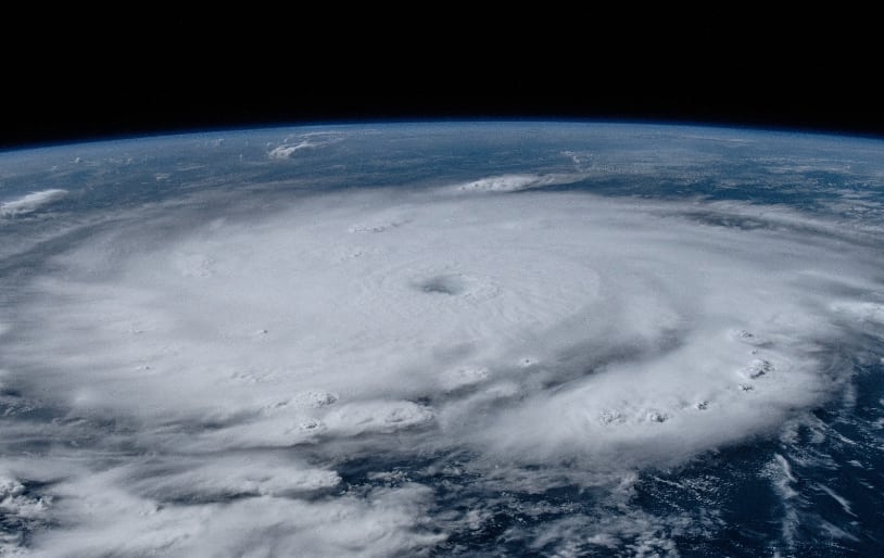
Current forecasts suggest limited reinsurance loss from Beryl landfall in Texas: BMS’ Siffert

In a Saturday update, Andrew Siffert, reinsurance broker BMS Re’s Senior Meteorologist, has said that, based on the latest forecasts and with Beryl taking longer to regain hurricane status, after weakening to a tropical storm overnight, the insurance industry loss from the storm could be largely retained in the primary market, without too much reinsurance impact.
As we’ve been explaining in our coverage today, Beryl weakened overnight to a tropical storm and has been struggling to regain its structure and intensify again over the Gulf of Mexico.
Siffert writes, based on the current forecasts from today and the latest projected path for what is expected to become hurricane Beryl again, that the most likely scenario appears to be “a high-end Category 1 hurricane with a landfall between Port O’Connor and Matagorda Bay, Texas.”
While additional intensification is possible, potentially right up to landfall as some of the models suggest, time is passing and the longer it takes Beryl to regain structure and become a hurricane again, the less time there is for that strengthening to occur.
Uncertainty remains though, Siffert highlights.
“A slight deviation south in the tracks could bring Beryl closer to the population center of Corpus Christi, Texas. In contrast, a northward wobble could bring it uncomfortably close to Galveston/Houston. The latest BMS iVision Verisk Respond forecast, a proprietary hurricane model, predicts a hurricane landfall 30 miles south along the Texas coastline from Freeport, Texas, as a category 1 hurricane. This underscores the need for local preparedness and vigilance on the potential impact of the central Texas coastline,” he explained.
Storm surge is also uncertain, with the forecasts from the NHC still being for 3 to 5 foot of surge along much of the Texas central coast.
But, should Beryl intensify and grow more than anticipated, which is possible given how the storm has outpaced the models to-date, surge could be more of a problem.
Most importantly though, “Landfall location matters immensely on the potential for insured loss. This is no different with Beryl, as insurance industry impacts will depend a lot on just how much Beryl intensifies and the exact landfall location,” Siffert cautions.
Going on to explain, “The Texas coast has large areas with low populations, and Beryl could slip through with only a few hundred million dollars in insurance industry loss. Suppose the wind core sweeps across Corpus Christi or edges close to the Houston area. In that case, the impact will easily top $1 billion, given its current intensity forecast.
“Regardless, having a landfall of only high-end category 1 or category 2 would still be a manageable event for the insurance industry, which would likely be a retained event by most carriers and have a very limited impact on the reinsurance industry given the current forecasts as of the morning of July 6th.”
At that level of loss, for the insurance-linked securities (ILS) market, there would not be a significant impact either, with catastrophe bonds typically calibrated to cover a higher category hurricane landfall. In addition, cat bonds and other excess-of-loss arrangements in the ILS market usually need a hurricane strike to be in a high-value region, with dense insured property concentrations, for any major losses to be felt.
One area of potential loss for ILS investors might be through quota shares, but even here this would not be significant in this scenario, of a high-end Cat 1 in central Texas, and retrocession arrangements would not typically respond to a Category 1 storm, in the main.
There are other scenarios though, although still seen as outliers based on the current forecasts.
“Insurance industry losses could be much different if Beryl takes a track closer to Corpus Christi, Texas, or Freeport, Texas, which is still a possible forecast scenario,” Siffert wrote.
Adding that, “Hopefully, the forecast holds, which would be welcome news to the insurance industry. However, Micheal, Laura, Ida, Harvey, Ian, & Idalia are why the insurance industry should still be on guard not to trust the type of circulation in the Gulf of Mexico.
“Still, as stated above, there is much less chance today of rapid intensification due to dry air and wind shear, but some deepening of Beryl is expected before landfall.”
Read Siffert’s full post for more useful insights here.
It is worth recalling Harvey’s last 48 hours on approach to Texas though, as it too was a ragged looking storm in the Gulf 48 hours prior to landfall, but of course made a run up to Category 4 and caused a relatively significant insurance and reinsurance market loss.
While Beryl currently isn’t forecast to do this, by any of the models, intensification could be faster and further than currently modelled or forecast, so the storm does still have a chance of surprising to the downside.
Track the 2024 Atlantic tropical storm and hurricane season on our dedicated page and we’ll update you as new information emerges.


