California facing “brutal” wind & rain impacts from atmospheric rivers

The US state of California is already facing flooding after torrential rains triggered by a first atmospheric river event that has driven storms and rainfall in from the Pacific, but forecasters are saying another “brutal” period of wind and rain is expected to begin from Wednesday that could exacerbate the potential insurance market loss situation.
Flooding and landslides have already hit the state after the flow of atmospheric rivers of moisture began, triggered by a major extratropical storm system that has deepened offshore of the US in the Pacific.
San Francisco experienced its second wettest day on record already on New Year’s eve, resulting in flooding, power outages and landslides in mountainous surrounding areas, but with inches more rain now expected over the coming days the situation is expected to worsen.
The Bay Area National Weather Service meteorologist Brian Garcia explained, “To put it simply, this will likely be one of the most impactful systems on a widespread scale that this meteorologist has seen in a long while.
“The impacts will include widespread flooding, roads washing out, hillside collapsing, trees down (potentially full groves), widespread power outages, immediate disruption to commerce, and the worst of all, likely loss of human life. This is truly a brutal system that we are looking at and needs to be taken seriously.”
Heavy rainfall from the so-called Pineapple Express atmospheric river event, where Pacific moisture is directed at the US west coast, is expected to soak parts of California including the Bay Area from Wednesday through at least Friday this week.
Between another 2 and 4 inches of rain are forecast for the Bay Area, with totals up to 6 inches in the coastal hills.
More broadly, 2 to 5 inches of rainfall are anticipated in other parts of Northern California, as well as snowfall in mountainous regions.
Southern California will also be hit, although forecasts suggest this could be more of an issue from Thursday, with total from 2 inches and up to as high as 6 to 8 inches in the mountains.
Urban flooding is anticipated, especially in Northern California and the Bay Area, with saturated ground likely to elevate the flood threat compared to recent days.
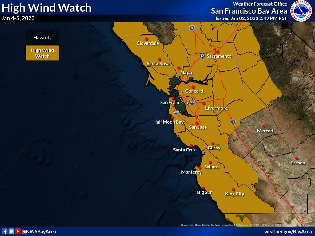
 Along with the rainfall, due to the deepening of the extratropical storm, that some are terming a bomb cyclone, strong winds are expected over the next few days as well.
Wind gusts of 40 mph to 60 mph are anticipated, with higher gusts on peaks and higher ground.
“These winds combined with already saturated soils will likely result in downed trees/limbs causing isolated to scattered power outages as well as potential property damage,” the National weather Service warns.
The flood threat is considered significant, with the possibility of “extensive street flooding in portions of the Bay Area and Central Coast.”
Overall, the weather threat for California is expected to persist for some days as well, with further atmospheric river type storm fronts expected over the next week or more.
“Widespread flooding and wind impacts expected from Wednesday into Thursday as a strong weather system and atmospheric river moves through the region. Subsequent weather systems will bring additional precipitation and periods of stronger winds this weekend and into at least early next week,” the National Weather Service said today.
But right now the highest impacts are expected Wednesday and into Thursday this week, but, “The storm door remains wide open as a series of weather systems are expected to bring more widespread rainfall and wind to the region this weekend into at least early next week.”
As ever, it’s challenging to know how impactful such an event could be for insurance and reinsurance market interests, but the severity of this event is being highlighted by industry meteorologists and therefore it’s considered a developing situation to watch.


