Why atmospheric rivers, derechos and bomb cyclones are on insurers’ radar

Wild and wacky weather events like atmospheric rivers, derechos and bomb cyclones may seem new because of recent media coverage, but they’ve been known and named phenomena for quite some time in the history of meteorology and atmospheric science, speakers said Tuesday at the CatIQ Connect conference.
What’s new is that they appear to be getting worse and more frequent as the climate changes. That means increasingly higher insured damage payouts for Canada’s P&C insurance industry.
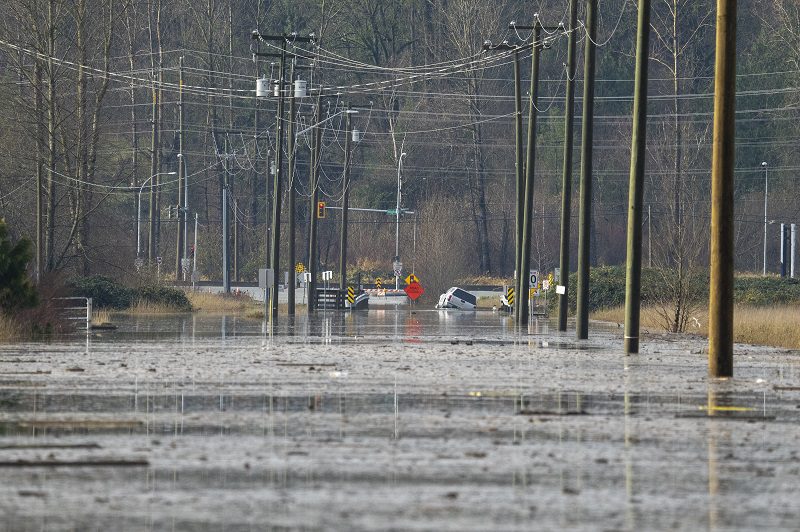
For example, a May 2022 derecho — a fast moving line of thunderstorms with strong winds — in Ontario and Quebec cost the P&C insurance industry at least $1 billion in claims payouts, while the November 2021 atmospheric rivers in British Columbia cost at least $675 million in insured damage.
When it comes to atmospheric rivers — which could be described as fire hoses or trains of moisture — and other weather phenomena, climate change is contributing to increased events. This in part can be attributed to the Clausius-Clapeyron relation, which says that for every one degree centigrade of warming, the atmosphere can hold at least 7% more moisture, said Steve Bowen, chief science officer with Gallagher Re.
“So, you get more of these atmospheric river events,” he said during the session, Atmospheric Rivers, Derechos, and Other Scary Things – Meteorology 101. “It’s tapping into warming ocean waters, it’s tapping into moisture environments, therefore, it’s actually dropping more precipitation down to the surface as well. So, if you get two or three or four consecutive [atmospheric rivers] in a row affecting a specific area, you tend to see much more precipitation falling and subsequent flooding.”
Climate change is contributing to old weather patterns taking on new forms, said Chris St. Clair, a former weather presenter and journalist at the Weather Network. “The more our climate changes, we start to see patterns that we had expected to be behaving a certain way now behaving in different ways. It gets to the unpredictability and the greater variability that we’re seeing.”
Houses along the shores of Lake Erie, near Fort Erie, Ont., remain covered in ice Tuesday, December 27, 2022, following a winter storm that swept through much of Ontario. THE CANADIAN PRESS/Nick Iwanyshyn
The phenomena themselves are not new, the speakers observed. For example, the term derecho has been around for more than 100 years.
And “bomb cyclone” as a term has been around for at least four decades. “This was in the news quite a bit just before Christmas and has been in the news a few times over the past couple of years,” said CatIQ director Caroline Floyd, referring to a storm that ‘bombs out’ or very rapidly intensifies over a 24-hour period. “These are pretty common up the eastern seaboard. And we’ve seen more of them – at least I’ve ever seen in my career – over the past few years occurring over the Midwest and parts of eastern Canada.”
The bomb cyclone, or bombogenesis, during the winter holiday in December cost Canadian P&C insurers an estimated $180 million in insured damage. The storm, which can occur over ocean and land, brought heavy snowfall, strong winds and blizzard conditions to much of North America between Dec. 21 and Dec. 26.
“You get this collision of colder air with warmer ocean water,” Bowen explained. “You get an area of lower pressure that develops. And when that interaction occurs, that difference in temperature and pressure tends to really lead to this intensification process. And then you get much stronger winds as the area of low pressure starts to expand.
“We’re not making these terms up,” Bowen said. “They actually have been around for quite a long time. And this one in particular (bomb cyclone) first started to pop up in literature around 1980.”
St. Clair added these bomb cyclones are essentially the rushing of the cold air into warm air. “They’re huge storms,” he said. “They rival, in many cases, what we would consider to be a hurricane in the summertime for wind strength. It’s not uncommon to see winds well over 100 kilometres per hour with winter storms in the [Atlantic Canada].
“They’re become more frequent. Never seen so many.”
Feature image: A pickup truck floats in the flood waters next to a road in Abbotsford, B.C., Monday, November 29, 2021. THE CANADIAN PRESS/Jonathan Hayward


