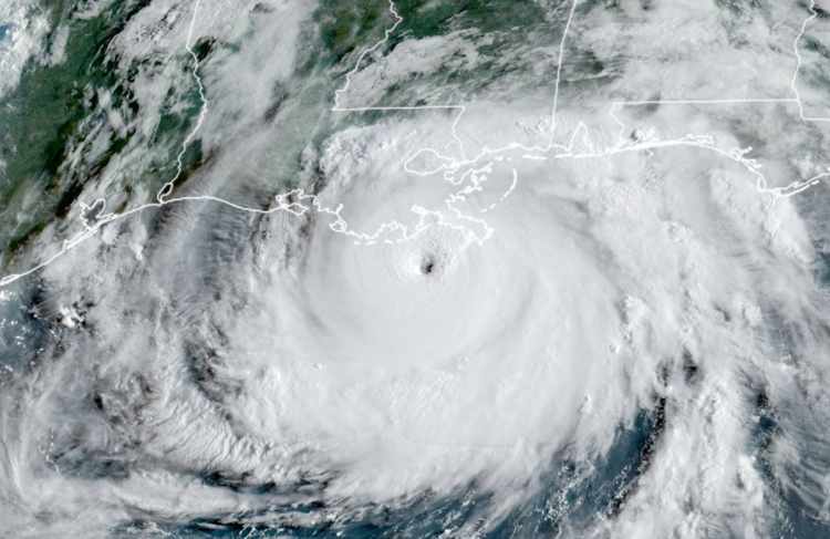
Hurricane season begins. ENSO favours cyclones. Florida in crosshairs

The 2022 Atlantic hurricane season officially begins today and the latest forecasts continue to suggest another active season ahead, while reinsurance firm Munich Re warns of ENSO conditions conducive to cyclone formation, while other forecasters warn Florida could be in the crosshairs this year.
The overall forecast expectation is for another particularly active Atlantic hurricane season in 2022.
Having added the latest forecasts to our page where you can track the season as it develops and access tracking maps and other storm specific information as they form, our Artemis average still sits at an active 19 named storms, 8 hurricanes and 4 major hurricanes, with Accumulated Cyclone Energy (ACE) of 153.
That’s a lot of tropical cyclone activity but, as ever, for the insurance, reinsurance and insurance-linked securities (ILS) markets it is where storms target, make landfall and cause losses that matters the most.
Which makes some of the forecaster commentary worth taking note of this year, as the 2022 Atlantic hurricane season is not just expected to be active, it’s also thought likely to see storms driven towards the United States, with Florida seen as particularly in the crosshairs.
Tropical Storm Risk, one of the insurance and reinsurance industry supported forecast teams, repeated its earlier season forecast, but also warned of the chance of “enhanced late season activity.”
“Whilst uncertainties still remain, TSR predicts that the 2022 hurricane season will be slightly less active than the two previous years, but may carry an increased risk in the latter part of the storm season. Ten years on from the late-season Superstorm Sandy, TSR point out that some Niño forecasts predict a slight strengthening of the current La Niña conditions through the autumn, which if verified, would increase the chance of enhanced late season activity,” the forecaster said.
EuroTempest’s Commercial Director Nick Wood added, “TSR’s latest update is consistent with the initial prediction of an active storm season. We consider that the more likely scenario is for tropical North Atlantic and Caribbean Sea waters to be slightly warmer than normal by August-September 2022, and for weak La Niña conditions to persist through late summer and into the autumn.”
“This is likely to contribute to reduced trade winds over the tropical North Atlantic and Caribbean Sea. Both these environmental factors are expected to enhance North Atlantic hurricane activity in 2022.”
Global reinsurance firm Munich Re also warned of the El Niño Southern Oscillation (ENSO) influence potential for the 2022 hurricane season.
“This year’s hurricane season could once again be exceptionally active. For the third consecutive year, the main phase of the stormy season in late summer will likely be characterised by climatic conditions that are favourable for storm formation over the North Atlantic. The last such string of years with these La Niña conditions was in 1998-2000,” the reinsurance company said.
Munich Re’s forecasters plump for 18 named tropical storms, 8 hurricanes and 4 major hurricanes for 2022, so aligned with other forecast teams.
“Three consecutive years of ENSO conditions, which favour tropical cyclones, is truly unusual. Needless to say, for insurers it is tremendously important to determine whether this was just a fluke or may become more common in future. In any case, whether and, if so, how climate change affects the ENSO phases like El Niño and La Niña is the subject of intensive research,” explained Anja Rädler, a meteorologist and climate researcher at Munich Re.
Other forecasters are suggesting an enhanced landfall potential, with Florida seen as potentially more in the crosshairs in 2022.
Factors from steering currents, to the position of the Bermuda high, the loop current, ENSO, wind shear and also coastal water temperatures all affect the chances of hurricanes impacting Florida.
AccuWeather senior meteorologist Dan Kottlowski gave Florida a 75% chance of being hit by a hurricane during the 2022 season, the highest probability of landfall location by state, followed by Louisiana as second-highest at 56%.
Regionally, Florida is also top, according to Kottlowski.
“The highest probability is going to be over the Florida Panhandle, which is part of that northern Gulf of Mexico area that’s been hammered the last several years,” Kottlowski told Florida’s Sun Sentinel newspaper. “Statistics are telling us that that’s going to be the case this year again.”
South Florida is the second highest region for landfall probability, while third is the US East Coast from Charleston, South Carolina, to Kitty Hawk, North Carolina, or perhaps as far north as Norfolk, Virginia.
With the 2022 Atlantic hurricane season now officially underway, the insurance, reinsurance, catastrophe bond and ILS market community will be keeping one eye on the tropics throughout the season.
Some of the forecast models are showing a chance of Pacific hurricane Agatha’s remnants gaining some organisation over the Gulf of Mexico and heading towards Florida in the coming days.
While seen as an outside risk, the National Hurricane Center gives a 70% chance of cyclone formation for this remnant low coming from Agatha, so this will perhaps deserve watching over the rest of this week.
Track the 2022 Atlantic tropical storm and hurricane season on our dedicated page and we’ll update you as new information emerges.


